Ĉi tiu dosiero estas de Wikimedia Commons kaj estas uzebla de aliaj projektoj.
Jen la priskribo en ties dosier-priskriba paĝo.
Resumo
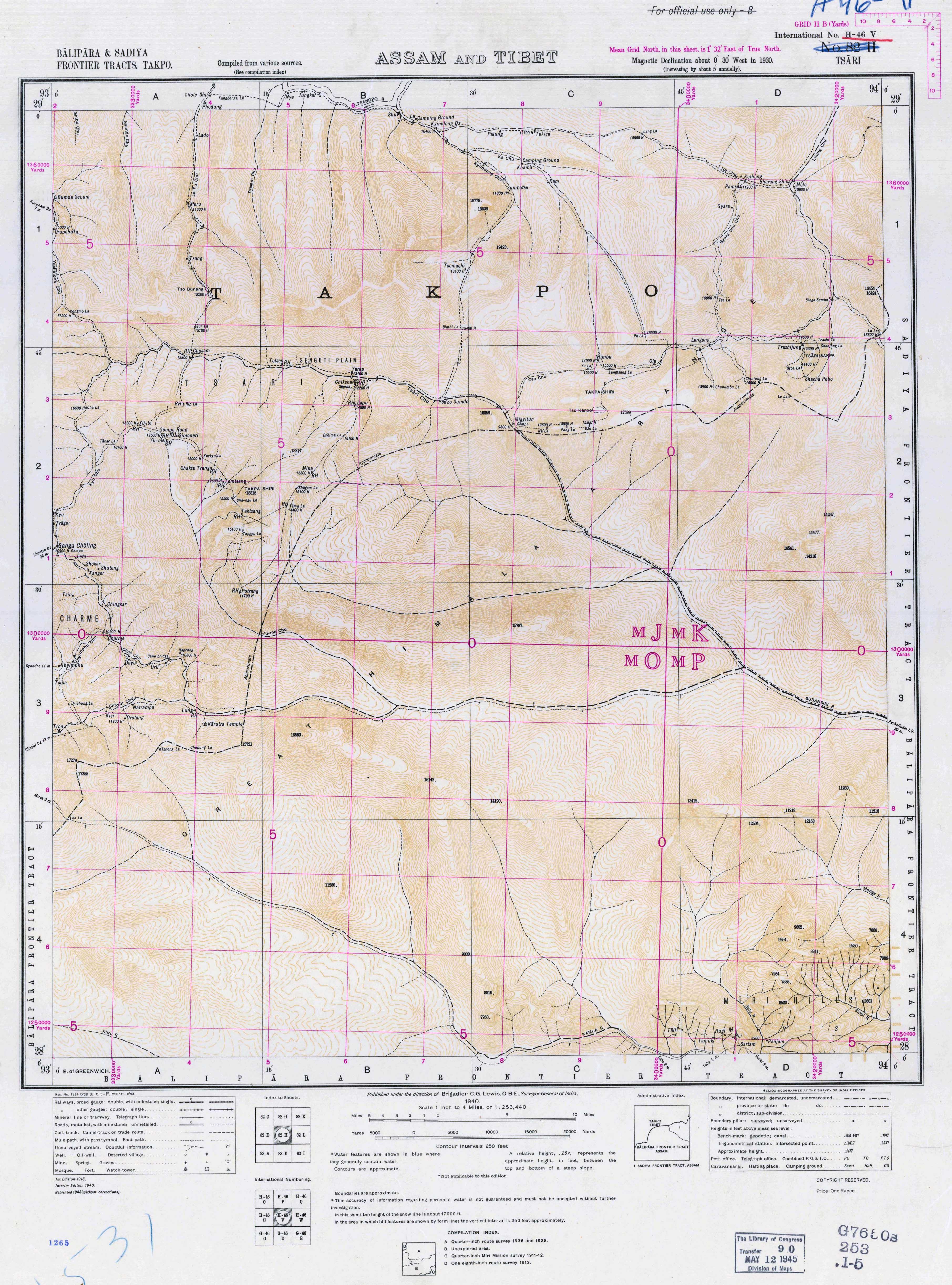
Priskribo1940 map of Tsari Chu and McMahon Line by Survey of India.jpg
English: The map shows the McMahon Line as depicted by the Survey of India in 1940. The line is close to the town of Migyitun, considerably north of that in 1914 treaty map.
Anonymous works, photographs, cinematographic works, sound recordings, government works, and works of corporate authorship or of international organizations enter the public domain 60 years after the date on which they were first published, counted from the beginning of the following calendar year (i.e. as of 2024, works published prior to 1 January 1964 are considered public domain).
Posthumous works (other than those above) enter the public domain after 60 years from publication date, counted from the beginning of the following calendar year.
Any kind of work other than the above enters the public domain 60 years after the author's death (or in the case of a multi-author work, the death of the last surviving author), counted from the beginning of the following calendar year.
Text of laws, judicial opinions, and other government reports are free from copyright.
The Indian Copyright Act, 1957 is not retroactive, so any work in which copyright did not subsist when it commenced did not have its copyright restored, and is in the public domain per the Copyright Act 1911.
You must also include a United States public domain tag to indicate why this work is in the public domain in the United States. Note that this work might not be in the public domain in countries that do not apply the rule of the shorter term and have copyright terms longer than life of the author plus 60 years. In particular, Mexico is 100 years, Jamaica is 95 years, Colombia is 80 years, Guatemala and Samoa are 75 years, and Switzerland and the United States are 70 years.
Uploaded a work by Survey of India from http://legacy.lib.utexas.edu/maps/topo/india_253k/txu-pclmaps-oclc-181831961-tsari-82-h-1940.jpg with UploadWizard
Ĉi tiu dosiero enhavas plian informon, verŝajne aldonitan de la cifereca fotilo aŭ skanilo uzita por krei aŭ skani ĝin. Se la dosiero estis modifita de sia originala stato, iuj detaloj eble ne konformos al efektiva stato de la modifita bildo.


